
August 3rd, 2006
This is not one of my email updates of the situation. Rather it is a set of descriptions of the photos I have put online on the blog. I received a request to put in captions but I have two reasons I am not yet doing so: 1) I don't know how and 2) I don't have good cheap Internet access, so it would be costly to do so. The descriptions are group by the date of the photo as listed on the blog, so you should be able to match things. I am sorry I haven't updated in a while, I had a pretty serious problem with my computer (hard disk died), and recovering has taken me a couple of days, but now I am back in business. Please note that the pictures are posted in more or less chronological order with the posts, but it isn't perfect (blogspot doesn't seem to put things in the same order as I do when I upload the pictures, and I don't care enough to fix them). That said, my descriptions I think are adequate.
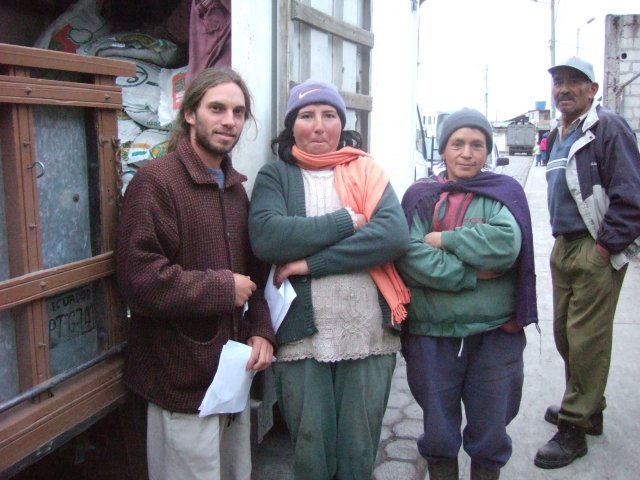
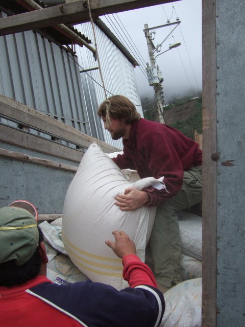
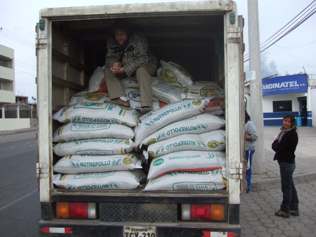
August 2nd-3rd: This is a set of photos taken on July 27th and 30th, our last two visits to make deliveries. Actually there is only one taken on the 30th, which is the picture of us with the community of San Juan (my next post will explain more).
The rest were taken on the 27th, when we were able to get a spectacularly clear view of Tungurahua, despite spending the trip there enclosed in the back of a cargo truck. In one pictures you can see from a distance the community of Cusúa and the lava flows that frame it. In another you can see the menacing Mama Abuela towering over Cotaló (the local administrative center) and above Cotaló's church. Finally, there are a set of photos more directly related to our work, showing John in the truck as we left Salasaca and then later helping deliver the food, me with members of the community of Mucubí and later a picture inside the communal building in Laurel Pamba where the sacks of food were being left for the community (and other scarce donations are in the background).
July 26th: These are more photographs taken when I went for the second time to the disaster zone, this time with John and animal food bought with the money that our families and friends have helped with. In one photo, you can see a chicken leg, all that remains of the chicken. In another is the head of a cow buried in ash. One could see the entire body half buried with legs sticking up in the air, but I preferred to post the simpler image. There is then a picture of me in front of the little plot of land and house closest to the dead cows. The other picture is of me and John eating cuy that the community of Pillate prepared for us. The president of the community, Iván Ojeda is the man in a sweater, while the guy with the reflective jacket is the coordinator of the Defensa Civil in the community. The other guy sitting next to me is Rosa's uncle, Eugenio. The photo was posed so that the reflectors on the middle guy's jacket didn't look awful in the flash.
July 22nd: These are pictures from when I returned with John. There are a few pictures taken from the bridge across the river that divides Grandma from the rest of the world. It shows the greyness of the valley southward. These pictures haven't been modified at all from what they originally were besides the reduction in size. Things really were that grey, as you can see in the picture that has Rosa and John (and Milton, a guy who helped us out), who are fully colored. There is then a picture of the pickup we came in, parked about as closely as possible to the lava flow (the lava flow was behind me as I took the picture). The ash in the sky was astounding, it looks like fog. Finally there is a picture from a day or two later of Chimborazo, Tungurahua's lover and the tallest mountain in Ecuador, many kilometeres from Tungurahua (60 degrees on the horizon) and now covered in ash. Chimborazo is always brilliantly white, but not after Grandma threw a jealous fit.
July 15th: There are three pictures taken from my backyard on the night that the action intensified. It was the first time I was able to see lava during the daylight, let alone capture it on camera. The house at the bottom of a couple of the pictures is my father-in-law's. The pictures were taken from my house. As can be seen in one of the pictures, the smoke clearly was headed in a southwesterly direction over a set of hills immediately to the south of Salasaca.
posted by Gabriel Many at 7:34 PM
![]()
![]()

0 Comments:
Post a Comment
<< Home